3D Computer Graphics with Python
Werbung
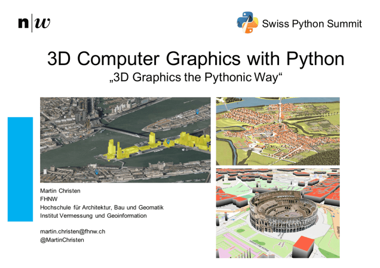
Swiss Python Summit 3D Computer Graphics with Python „3D Graphics the Pythonic Way“ Martin Christen FHNW Hochschule für Architektur, Bau und Geomatik Institut Vermessung und Geoinformation [email protected] @MartinChristen About this talk In this talk several technologies around 3D graphics for Python are presented. • A brief introduction to scripting Blender shows the possibilities of creating complex 3D Worlds and games. • The second part shows how to create low level 3D applications and how Python is used to create preprocessed 3D worlds for the webbrowser. Institut Vermessung und Geoinformation Swiss Python Summit, February 5, 2016 2 PART I: Python and Blender What is Blender ? • Blender is a free and open source 3D creation suite for: • Modelling • Animation • Simulation • Rendering • Video Editing • Motion Tracking • Game Creation • …and more.. • Runs on Linux, MacOS and Windows Institut Vermessung und Geoinformation Swiss Python Summit, February 5, 2016 3 Cycles Demo Reel (2015) – All made with Blender https://www.youtube.c om/watch?v=wDRTjzLNK0g Institut Vermessung und Geoinformation Swiss Python Summit, February 5, 2016 4 Blender Motion Tracking https://www.youtube.c om/watch?v=2AvQiOf2IGA Institut Vermessung und Geoinformation Swiss Python Summit, February 5, 2016 5 Python Scripting in Blender Choose the Scripting View: Institut Vermessung und Geoinformation Swiss Python Summit, February 5, 2016 6 Python Scripting in Blender Now you see the Python 3.x console: Institut Vermessung und Geoinformation Swiss Python Summit, February 5, 2016 7 The first program: Accessing Data is quite simple, use the module bpy.data: list(bpy.data.objects) list(bpy.data.scenes) list(bpy.data.materials) So let’s enter the following in the Python console: >>> list(bpy.data.objects) Institut Vermessung und Geoinformation Swiss Python Summit, February 5, 2016 8 List of all objects in the scene: And that is pretty much what you see in the scene graph: Institut Vermessung und Geoinformation Swiss Python Summit, February 5, 2016 9 Python Scripting in Blender Open the Tab in the 3d View and select “Create”: Institut Vermessung und Geoinformation Swiss Python Summit, February 5, 2016 10 Python Scripting in Blender When you hold mouse over “Cube” you will see the Python Command how to create a cube! Just note it and click on cube. Institut Vermessung und Geoinformation Swiss Python Summit, February 5, 2016 11 Python Scripting in Blender When you create the cube you will see the exact command that was called to create it. You see most actions as Python code there. Institut Vermessung und Geoinformation Swiss Python Summit, February 5, 2016 12 Python Scripting in Blender: Adding (predefined) Objects Right click on the text (highligh) and copy the text (ctrl-­c) bpy.ops.mesh.primitive_cube_add(radius=1, enter_editmode=False, location=(0, 0, 0), False, False, False, False, False, False, False, False, False, False, False, False, view_align=False, layers=(True, False, False, False, False, False, False, False)) Hit undo (ctrl-­z) And now we modity the command using location=(0,3,0) and radius=2: bpy.ops.mesh.primitve_cube_add(radius=2, location=(0,3,0)) Institut Vermessung und Geoinformation Swiss Python Summit, February 5, 2016 13 Python Scripting in Blender: Transform objects If we move the new cube by pressing and holding the blue z-­Axis we can see the following command: bpy.ops.transform.translate(value=(0, 0, 3.10625), constraint_axis=(False, False, True), constraint_orientation='GLOBAL', mirror=False, proportional='DISABLED', proportional_edit_falloff='SMOOTH', proportional_size=1, release_confirm=True) That is how an object is translated Institut Vermessung und Geoinformation Swiss Python Summit, February 5, 2016 14 Python Scripting in Blender: Operations Apply Operations like Subdivision: bpy.ops.object.mode_set(mode='EDIT') bpy.ops.mesh.subdivide() bpy.ops.mesh.subdivide() bpy.ops.mesh.subdivide() bpy.ops.object.mode_set(mode=OBJECT') Institut Vermessung und Geoinformation Swiss Python Summit, February 5, 2016 15 Creating Meshes for example: Tetrahedron import bpy s = 0.5**0.5 # 0.5*sqrt(2) verts = ((s,s,-1), (s,-s,-1), (-s,-s,-1), (-s,s,-1), (0,0,1)) faces = ((1,0,4), (4,2,1), (4,3,2), (4,0,3), (0,1,2,3)) mesh = bpy.data.meshes.new("TetrahedronMesh") object = bpy.data.objects.new("TetrahedronObject", mesh) object.location = (0,0,0) # origin scene = bpy.context.scene scene.objects.link(object) scene.objects.active = object object.select = True mesh.from_pydata(verts, [], faces) mesh.update() Institut Vermessung und Geoinformation # vertices, edges, faces Swiss Python Summit, February 5, 2016 16 Real Life Example Using Python to optimize 3D objects: bpy.ops.object.select_all(action='DESELECT') bpy.context.scene.objects.active = bpy.data.objects[1] bpy.ops.object.select_all(action='SELECT') bpy.ops.object.join() bpy.ops.object.mode_set(mode='EDIT') bpy.ops.mesh.dissolve_limited() bpy.ops.mesh.remove_doubles(threshold=0.01) bpy.ops.mesh.select_all(action='DESELECT') bpy.ops.mesh.select_interior_faces() bpy.ops.mesh.delete(type='FACE') bpy.ops.object.mode_set(mode='OBJECT') Institut Vermessung und Geoinformation Swiss Python Summit, February 5, 2016 17 Historic Roman City “Augusta Raurica” – Generated with ESRI City Engine Institut Vermessung und Geoinformation Swiss Python Summit, February 5, 2016 18 Cleaned up: Jour, Remove Double Vertices/Faces, Interior Faces Institut Vermessung und Geoinformation Swiss Python Summit, February 5, 2016 19 Final Result (125’929 triangles optimized to 56’216 triangles) Institut Vermessung und Geoinformation Swiss Python Summit, February 5, 2016 20 Institut Vermessung und Geoinformation Swiss Python Summit, February 5, 2016 21 PART II: Low Level APIs • OpenGL API bindings • Open Graphics Library -­ based on C • http://pyopengl.sourceforge.net/ • DirectPython 11: Direct3D 11 (Windows only) • http://directpython11.sourceforge.net/ • Not Cross Platform Institut Vermessung und Geoinformation Swiss Python Summit, February 5, 2016 22 PyOpenGL Supports OpenGL 1.1 to 4.4 Works with popular GUI libraries, for example: • wxPython • PyQT / PySide • PyGTK • PyGame • Tkinter (+ Togl widget) I‘m not going to make an OpenGL introduction here... Institut Vermessung und Geoinformation Swiss Python Summit, February 5, 2016 23 How OpenGL Works Primitives (=Points, Linies, Triangles) are converted to Fragments (Pixels). Program Vertex-­Operations (e.g. projection, transformation). Program Fragment-­Operations for shading/lighting/texturing. Vertex/Fragment Shaders [run on the GPU and] are written in GLSL. Institut Vermessung und Geoinformation Swiss Python Summit, February 5, 2016 24 Vispy: http://vispy.org/ ( https://github.com/vispy/vispy ) VisPy is a young library under heavy development at this time. It targets two categories of users: • Users knowing OpenGL, or willing to learn OpenGL, who want to create beautiful and fast interactive 2D/3D visualizations in Python as easily as possible. • Scientists without any knowledge of OpenGL, who are seeking a high-­level, high-­performance plotting toolkit. Institut Vermessung und Geoinformation Swiss Python Summit, February 5, 2016 25 Install vispy 1) Numpy is required 2) OpenGL is required 3) A compatible GUI Toolkit is required Then: pip install vispy More info: http://vispy.org/installation.html Institut Vermessung und Geoinformation Swiss Python Summit, February 5, 2016 26 Example, lets create a virtual environment named “gl” python3.5 -m venv gl source gl/bin/activate pip install vispy pip install pyglet # also installs numpy … do your stuff … Deactivate Institut Vermessung und Geoinformation Swiss Python Summit, February 5, 2016 27 Development Version (currently 0.5.0.dev0) git clone git://github.com/vispy/vispy.git cd vispy python3.5 setup.py develop (Only this version support Jupyter Notebook!) Institut Vermessung und Geoinformation Swiss Python Summit, February 5, 2016 28 Windows on Windows, download modules* from: http://www.lfd.uci.edu/~gohlke/pythonlibs *) vispy, numpy & pyglet Institut Vermessung und Geoinformation Swiss Python Summit, February 5, 2016 29 Our first App import sys from vispy import app, gloo canvas = app.Canvas(app='pyglet', keys='interactive', size=(800, 600)) @canvas.connect def on_draw(event): gloo.set_clear_color((1.0, 0.0, 0.0, 1.0)) gloo.clear() canvas.show() if __name__ == '__main__': app.run() Institut Vermessung und Geoinformation Swiss Python Summit, February 5, 2016 30 Use Shaders, Geometry Institut Vermessung und Geoinformation Swiss Python Summit, February 5, 2016 31 Jupyter Notebook (WebGL Output) Institut Vermessung und Geoinformation Swiss Python Summit, February 5, 2016 32 Python for Data Processing • Virtual Globe using WebGL • Open Source Project started in April 2011 • JavaScript Library for rapid development of web-­based geospatial 3D applications • Data Processing in Python Institute of Geomatics Engineering 2.5.2016 33 Demo Institute of Geomatics Engineering 2.5.2016 34 Streaming 3D-­Geometry Tiles BTh Hürbi/Daetwyler, MTh Lucas Oertli, 2013 Institute of Geomatics Engineering MapData © OpenStreetMap contributors 2.5.2016 35 Streaming Example: 3D Geometry using OSM and “BOI” (worldwide streaming) MTh Lucas Oertli, 2013 Institute of Geomatics Engineering 2.5.2016 36 Streaming Example: Osnabrück (local streaming) Created by Geoplex with Plexmap, based on OpenWebGlobe Institute of Geomatics Engineering 2.5.2016 37 Some Problems I have with (Web-­Based) Virtual Globes • Unfortunately, WebGL compatibility is still an issue… a “fallback” is required • Most people still prefer 2D Maps • Navigation in 3D is too complicated for many users… • In the “Geo-­World”, 3D Models are usually not built by 3D game designers: • Often there are “too many” & “too big” textures per object • Different details per 3D-­object • Remember “Google 3D Warehouse” • Level of Detail: Generalization in 2D is accepted, but not in 3D! • Limited number of people actually do have data of the whole world… • Most virtual globe based applications I k now are limited to a certain region/country/… • Too slow (bandwidth/3D rendering) on mobile devices • Too power consuming on mobile devices Institute of Geomatics Engineering 2.5.2016 38 Bringing together 2D Maps and 3D Globes Concept: Prerender a 3D Scene using a high quality offline 3D renderer using an orthographic projection and create “2D” image tiles. Constant, minimal bandwidth regardless of the complexity of the 3D city model MTh Markus Jung, 2014 (Similar approaches were already done by Döllner et al. and also go back to s ome c oncepts by Sutherland) Institute of Geomatics Engineering 2.5.2016 39 Display in the Webbrowser as “2D Map” MTh Markus Jung, 2014 Institute of Geomatics Engineering 2.5.2016 40 Display in the Webbrowser as Panorama MTh Markus Jung, 2014 Institute of Geomatics Engineering 2.5.2016 41 High Resolution Geometry doesn’t matter: Same download/render speed MTh Markus Jung, 2014 Institute of Geomatics Engineering 2.5.2016 42 The 3dmaps.ch Project: Bringing it all together! 3DPS (3D Portrayal Service) Institute of Geomatics Engineering 2.5.2016 43 Viewer API map3d.js Library var map = new map3d.map("mapcanvas"); var layer = new map3d.imageLayer([ "http://t1.3dmaps.ch/tiles/teatime", "http://t2.3dmaps.ch/tiles/teatime", "http://t3.3dmaps.ch/tiles/teatime", "http://t4.3dmaps.ch/tiles/teatime"]) }); layer.addTo(map); var teapot_marker = new map3d.marker("Green Teapot", [0,0,0]); teapot_marker.addTo(map); var cube_maker = new map3d.marker("Green Cube", [80.5, 11.5, 10.5]); cube_maker.addTo(map); Institute of Geomatics Engineering 2.5.2016 44 Different prerenderings for different pitch/view direction Every Prerendering needs storage, but with todays cloud storage pricing this is not really an issue anymore! Institute of Geomatics Engineering 2.5.2016 45 Why a teapot if we have (open) Geo Data ?!! Use case 1: Rotterdam Dataset 90 CityGML files with a total size of 2.72 GB 26'474 textures with a size of 1024x1024, an uncompressed total data volume of around 77 GB Orthophoto uncompressed 430 GB Institute of Geomatics Engineering 2.5.2016 46 Use case 2: The Roman city of Augusta Raurica A digital reconstruction of the historical Roman City of Augusta Raurica, created at the institute of Geomatics Engineering at the FHNW. 3D-­Printed to create a bronze model. Institute of Geomatics Engineering 2.5.2016 47 The 3D Model About 4000 geospatial objects (buildings, roads, vegetation features, terrain, …) at three levels of detail. 3D Geometry & Textures around 1 GB Institute of Geomatics Engineering 2.5.2016 48 Prerendering the Model: Color Map, Normal Map, Id-­Map, Depth Map Dynamic Lighting Normal Map: for Object Identification: Highlighting, special effects, … Depth Map: for 3D Position, special effects, … Institute of Geomatics Engineering 2.5.2016 49 3D View in the (mobile) webbrowser with dynamic Lighting Institute of Geomatics Engineering 2.5.2016 50 The Viewer • The viewer basically uses the same concepts as a “2D Map Viewer” • map3d.js supports WebGL There is also a pure canvas version available as fallback • Operations like “highlighting” are highly customizable. Basically it is an image processing operation which runs on the GPU (WebGL Version). If there is no WebGL available, the operation is done using JavaScript. Institute of Geomatics Engineering 2.5.2016 51 Outlook (1) • Implement more effects and lighting models, dynamic snow/water/etc. using depth map & normal map • Layer management (include point clouds, mix different layers using depth map • Add realtime content (“mix real 3D Object”) using depth-­map • Release map3d.js as Open Source (around Q2/2016) Institute of Geomatics Engineering 2.5.2016 52 Outlook (2) More Rendering Effects, for example Screen Space Ambient Occlusion (SSAO) BTh, Daniel Rettenmund 2015 Institute of Geomatics Engineering 2.5.2016 53 Outlook (3) • “isometric maps” will be one of many features of OpenWebGlobe 2 • “isometric maps” will be the default 3D Viewer in OpenWebGlobe 2 • Switch to “real 3D” anytime • State is saved: • The best matching viewpoint is selected when switching • If you highlight an object in “isometric mode”, it will be highlighted in “Real 3D” mode too. Institute of Geomatics Engineering 2.5.2016 54 Conclusion 3 ways to use 3D Graphics in Python were presented: 1. Using Python & Blender (including Blender Game Engine) 2. Using Low a Level API (OpenGL/WebGL) 3. Using Python to process 3D Views Which approach is the best for Python ? This really depends the application domain. I am quite sceptic with 2. -­ If you want to create a complex 3D game, I don’t recommend using Python at this time. I believe Python is great for 1. and 3. Institut Vermessung und Geoinformation Swiss Python Summit, February 5, 2016 55 Next Meetup: February 9th, 2016 in Muttenz (near Basel) 18:00 to 21:00 http://www.pybasel.ch Institut Vermessung und Geoinformation Swiss Python Summit, February 5, 2016 56 1st GeoPython Conference http://www.geopython.net Institut Vermessung und Geoinformation Swiss Python Summit, February 5, 2016 57 Q&A Institut Vermessung und Geoinformation Swiss Python Summit, February 5, 2016 58
