geological field trip to the northern calcareous alps
Werbung
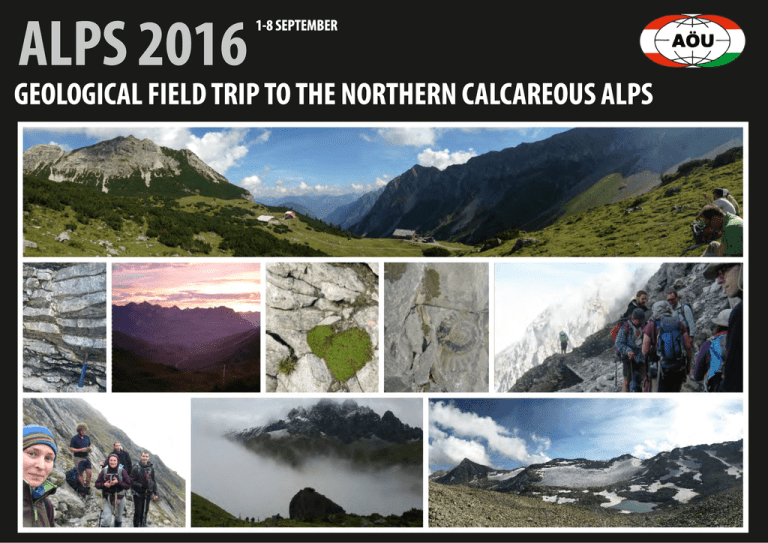
ALPS 2016 1-8 SEPTEMBER GEOLOGICAL FIELD TRIP TO THE NORTHERN CALCAREOUS ALPS ALPS 2016 1-8 SEPTEMBER Introduction Die Zielsetzung unseres Projekts ist, unsere Studenten mit der Geologie der Nördlichen Kalkalpen durch eine Geologische Feldübung bekannt zu machen. Diese mehrtägige Feldübung würde uns eine gute Gelegenheit bieten, um die Ähnlichkeiten und die Unterschiede zwischen den ungarischen und alpinen Gesteinen vor Ort zu studieren. Die Sedimente der Nördlichen Kalkalpen wurden zwischen dem Ober-Perm und dem tieferen Jura auf einem typischen passiven Kontinentalrand abgelagert. Die ältesten bekannten Gesteine sind Mergel, Sandsteine und Schiefertone, die nur wenig deutlich hervortreten. Das größte Volumen der Kalkalpen besteht aus Kalksteinen und Dolomiten aus dem Trias-Zeitalter. Die bekanntesten und mächtigsten Formationen von ihnen sind der Hauptdolomit, der Wettersteinkalk und der Dachsteinkalk. Diese Gesteine bauen auch die Mehrzahl der höchsten Gipfel der Kalkalpen auf, wie zum Beispiel den Hohen Dachstein, den Watzmann und den Hochschwab. Die meisten Schichtglieder des Jura sind Mergel, Kalke und kieselige Kalke, die in der Tiefsee abgelagert wurden. Die Gebirgsbildung der Alpen startete im Jura, als das östliche Meeresbecken des Neotethys-Ozeans sich zu schließen begann und sich der erste Deckenstapel entwickelte. Vom Kreide-Zeitalter an wurde dieser jurassische Deckenstapel mehrfach tektonisch überprägt und verändert, und dabei wurden die Nördlichen Kalkalpen durch tektonische Bewegungen an ihrem heutigen Platz transportiert. Die meisten wichtigen strukturellen Einheiten und Decken der Nördlichen Kalkalpen werden während der Geländeübung besichtigt. Wir möchten auch Deformationsstrukturen, wie zum Beispiel Deckenüberschiebungen, Falten und Verwerfungen ausführlich studieren, da solche in Ungarn nicht oder nur in begrenztem Ausmaß beobachtbar sind. Deswegen ist es für die ungarischen Studenten äußerst wichtig, diese Gesteine direkt im Gelände zu sehen, um die Bildung und die Bedeutung dieser Strukturphänomene besser zu verstehen. 93öu4 Jurassic tectonics at Schesaplana, Vorarlberg (Rätikon) Our first field day was dedicated to examine the Jurassic tectonics at Schesaplana in Vorarlberg. We strated at Melkboden (1620 m) where saw some examples for early deformation in calcareous sediments (slump). Then we walked up through Oberzalimhütte to Mannheimer Hütte (2679 m) while examined some nice examples those Jurassic tectonics mentioned above. Slump: early deformation in calcareous sediment N S Oberzalimhütte S N N Hau S ptd olo Köss en mit N Alg äu e View from the Mannheimer Hütte me li ät rrh e Ob View from halfway to Mannheimer Hütte: T3: Kössen, Hauptdolomit, Oberrhät limestone, J1: Algäu n sto Krabachjoch Klippen, condensed sedimentary succession of Zürser Schwelle, Aptian to Cenomanian synorogenic sedimentary succession On our second field day we walked to Trittalm, Gondelbahn Rüfikopf, Bockbachsattel and then to Rauekopfscharte. In the Northeren Calcareous Alps the nappe stack is translated towards the NNW, which caused the nappe units extending over the whole orogen. The shape of the nappes are controlled by the occuring facies boundaries. The thrust between the Lechtal and Inntal nappes was cut by previous folding. The Upper Triassic Dolomites from the westernmost part of the Inntal nappe overlie the Cenomanian synorogenic deposites. Since the Inntal succession was eroded down to the Upper Triassic sequences, it contains no Jurassic sediments. This was caused by the Upper Cretaceous Gosau groups synorogenic deposition. Therefore the Gosau was placed directly above the Haupt Dolomite with an angular unconformity. This is the youngest part of the sedimentological succession which was deposited in shallow marine environment. Sunset view from Stuttgarter Hütte Inntal Upper Triassic cliffs placed on top of Lechtal Upper Jurassic and Creatceous successions Sequence boundary Geometry of growth strata in a transpressive fold belt: Gosau Group at Muttekopf Our third field day was dedicated to examine the large-scale geometries of growth strata in transpressive settings at Muttekopf. The panoramic views provided an excellent way to understand the different structures, resulted geometries and their relationships. In general the thrust sheets of the Northern Calcareous Alps were emplaced during Late Cretaceous thrust-dominated transpression. Thrust sheet-top sediments were deposited during thrusting and associated fold growth and were controlled by active folding and tearing. Episodic tear fault activity may create several angular unconformities attached to a tear fault. View from the west of the Muttekopf syncline (centre) and the Larsenn anticline in the ridge Muttekopf-Rotkopf. N Muttekopf Uppe S r Gos Hauptdolomit au Hanauer Hütte S N The presence of fault-related progressive unconformities shows that the Gosau Group of Muttekopf was deposited in a zone affected by active folding and tearing. N Analogue model experiment of growth structure (Ortner et al. 2015) S Reichspitze Hau ptd Hauptdolomit Uppe r Gos au unconfo r a rmity Schlenkerk olo mit Geometry of growth strata in a transpressive fold belt: Gosau Group at Muttekopf II. During our fourth field day we could take a closer look on the stratigraphy of the Santonian-Campanian part of the Upper Gosau Subgroup. The sedimentation started with the deposition of dolo-conglomerates of alluvial fans, which is overlaid by shallow marine Inoceramus marl. The cover turbiditic succession is built up by upward coarsening sequences: first deep marine black shales, than turbiditic sandstone with Bauma series were deposited. Upward, thick deep marine conglomerate intercalations are more and more frequent. The overlying shales of the next sequence caused fluid overpressure in the conglomerate body, which resulted the fluidisation and the chaotic mix of these soft-sediments. In the turbitic sandstone trace fossils and spectacular soft-sediment fold (slumps) occured. W E rate Hauptdolomit er wat te era te -wa p dee itic st and s NW Trace fossils Soft-sediment fluidisation m glo n r co id turb Slump fold in sandstone, which is covered by conclomerate. g con p- dee one SE e lom Syn-sediment deformation on passive margins: Rofan Mountains W E We finished our field trip in the Rofan mountains. SHere we had the chance to study the geometry of the Rofan Breccia which was dragged along the active normal fault (at left). We can interpret this geometry as a clear evidence for the syn-tectonic sedimentation of the breccia. ia an Rof cc Bre ia Rofan Brecc Neptunian dyke or olistolith (white limestone) in the Lower Jurassic Red Limestone▼ ne to imes tL hä berr co nt a ct O ne to imes ät L rrh Obe Reconstructed geometry of the syn-tectonic Upper Jurassic Rofen Breccia above the Upper Triassic Oberrhät Limestone ▲ Elsewhere we see thrusts and large scale folds which also formed at the same time as the Rofan Breccia and the extencional folds. How is that possible? Rofan Breccia Contemporanous breccia deposition, normal faulting, thrusting and folding indicate large scale slumping. In the Rofan mountains slumping is related to the Upper Jurassic Ruhpolding Radiolarite Red Limestones initiation of the thrusting at the seafloor previuosly formed by extension (at right). The thrusting caused instability on the slopes where slumping occured. Oberrhät Limestone Interpretation of the observed structures in the Rofan Mountains ► Kössen Formation Modified after Brandner & Gruber 2011 Relationship of the Inntal and Lechtal thrust sheets On the fifth day of the field trip, our team had the possibility to take a look at the relationship of the major tectonic units of the Northern Calcareous Alps in the Karwendel Mountains. During the ascent from the Eng valley, we could examine the Inntal thrust from many different views. The interpreted field panorama photo shows the northwards thrusting of the Early Mesozoic strata by the Late Cretaceous Inntal thrust. The thrusting resulted in the formation of a kilometre-scale anticline building up the Gamsjoch. Some minor out-of-sequence thrust faults occurred during the folding. The Inntal thrust and its related fold is crosscut by a later (supposedly Neogene) northwestward breakthrough-thrust. According to the classical nomenclature of Tollmann (1976), the boundary between the Inntal thrust sheet and the Lechtal thrust sheet is the breakthrough-thrust. However, both thrust sheets are built up by the same succession, so their subdivision into two tectonic units is questionable, and may reflect to the importance of considering the lateral variability of even the most significant structures of an area. SSW Binasalm-Niederleger provided the accomodation place on our last night on the field. Inntal thrust sheet sensu stricto Lechtal thrust sheet sensu stricto Gamsjoch Gumpenspitze hrust Inntal t ug ro kth a bre Various Lower Jurassic clastic sediments Kössen Fm. (Upper Triassic) Wetterstein Fm. (Middle Triassic) Reifling Fm. (Middle Triassic) Steinalm Fm. (Middle Triassic) Virgloria Fm. (Middle Triassic) Reichenhall Fm. (Lower to Middle Triassic) t us hr h-t NNE ALPS 2016 1-8 SEPTEMBER 93öu4 Acknowledgements First of all, we are very greatful for the financial support of the Austrian Hungarian Action Foundation (93öu4). Special thanks to our local host and leader, prof. Hugo Ortner. Without his help and exceptionally interesting guidance, our field trip would not have been organized.
